SHROPSHIRE: WALK 06: THE BUCKNELL HILL CIRCULAR
£1 for my time
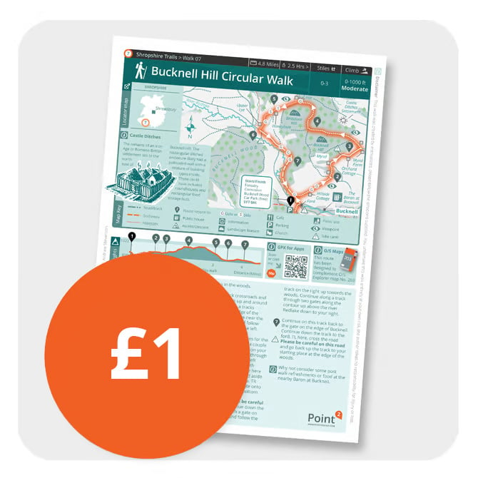
Each guide sheet represents about 12-15 hrs of dedicated creation time on my part. To ensure that I create more new routes and to help offset some of the outgoings I incur when testing and then mapping these guides I've moved up to a token fee of £1 per guide sheet. That's still a great deal for 12-15 hrs of time put to each of these map sheets and it helps to ensure that more will be created from here onwards too..
Route description
A lovely route near the Welsh border that takes you up from the outskirts of the village of Bucknell in Shropshire slowly but surely onto Bucknell Hill with it's wooded summit. Alongside the walk are the remainder earthworks of the ancient Romano-British settlement of Castle Ditches which we feature on the walk sheet.
Distance Approx 4.8 miles
Parking Forestry Commission Bucknell Wood roadside parking (free) at: SY7 0AL
Stiles 0-3
Difficulty Moderate
Suggestion Why not consider calling in to the nearby Baron at Bucknell (see map) for a refreshing drink or snacks after your walk.
GPX file Available via clickable link on the .pdf route sheet.