
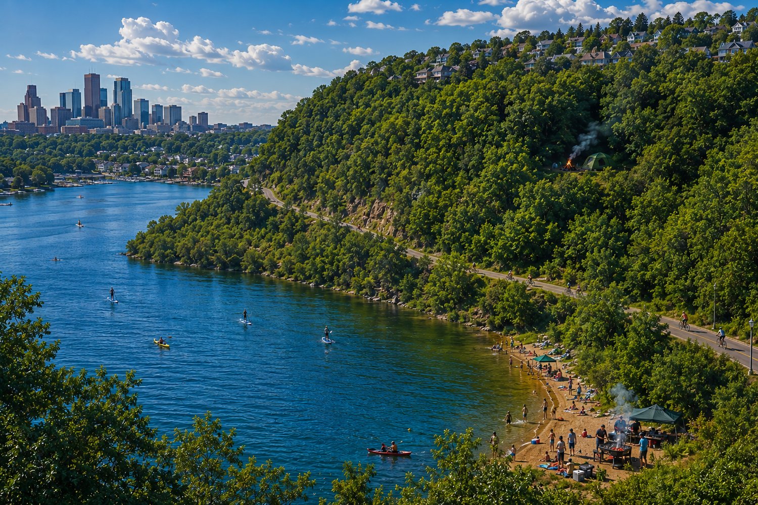
Most people walk through the city seeing only the pavement, the traffic, and the headlines. They do not know how to read the landscape. But if you are a native of the brush, you know that the Father has hidden a wilderness grid right inside the city map. This is our hill country. These former glacial slopes and deep basins of water are modern strongholds—mirroring the ancient Wilderness of Ziph and the Judean heights where David stayed in the woods, completely invisible while standing in plain sight.
- The Ancient Foundation of the Walls: The dramatic elevations of this landscape were forged ten thousand years ago by the staggering power of the Laurentide ice sheet. As the massive Wisconsin glaciers receded, they gouged out paleo-river channels deep beneath the surface and bulldozed walls of gravel and sand into massive ridges. Gigantic, broken blocks of glacial ice were left behind, buried deep in the sediment. When these ice blocks melted, the earth collapsed, leaving behind irregular, clay-lined depressions that filled with living water. These deep, steep glacial kettle basins became the connected fortresses we walk today.
- The Names and the First Inhabitants: Long before modern paths were paved, the true guardians of this land—the Dakota people—moved through, understood, and named these waters. The massive, sweeping water we call Bde Maka Ska translates directly to White Earth Lake, named for the pale clay of its shores. To the north sits Lake of the Isles, which the Dakota called Wita Topa, meaning Four Islands Lake, referring to the natural landforms that rose from its original marshy borders. Cedar Lake was a sacred buffer zone between the Dakota and the Ojibwe tribes, a natural food trail lined with the native trees that gave it life.
- A Guided Journey Through the Terrain: To navigate this land like the scouts of old, you must let your feet track the physical geometry of the terrain. Step out across the wide, level flats of the shorelines where the water meets the land, and notice how quickly the earth shifts. Your path leads you up the steep, rugged slopes of the former glacial walls. As you climb, you leave the low ground behind and scale the rising ridges that ring the basins. Push past the final treeline to reach the high crest of the hill country, navigating the high summits that serve as your natural watchtowers. From those peaks, look down into the deep, shaded valleys and low hollows where the city noise completely dies out, swallowed by the heavy timber.
- The Assembly on the Sands: Look at the shorelines on a hot summer day. You see the crowds gathering down on the green grass of Wita Topa or spreading out across the wide sands of South Beach at Bde Maka Ska. They set out their blankets, pour pure water into glasses, and lay out bowls of fruit right out in the open sun, mirroring the gatherings outside the ancient city gates of antiquity. Along the perimeter tracks, cyclists stream steadily down the paved paths, their wheels spinning in a constant loop that paces the movement of the water like chariots patrolling a fortress wall. Tucked away on the immediate shorelines and the rising slopes, people read books or quietly enjoy the expansive views from their hillside homes near the banks of the channel. They are anchored in their temporary dwellings, taking in the serene landscape from their perches.
- The Set-Apart Provisions: Whether down on the flats watching the people paddle their skiffs and cast their lines or up in the brush, pure water is the lifeblood here. There is no heavy indulgence on these shores. If you do catch us eating out here on the slopes, it is clean salads and fresh fruits—the simple, unrefined provisions of the prophets that keep the mind sharp and the body light for the long walk. We keep our temples clean and our senses sharp, exactly like the scouts of old.
- The Public Arrays vs. The Hidden Stronghold: If you walk the eastern shore of Wita Topa or step into Kenwood Park, you will see hammocks everywhere. They hang in bright, colorful arrays, completely visible to the world. But that open display is not the path of the scribe. The native of the brush moves past the public lawns and pushes up deep into the heavy, untamed overgrowth on the crests of Theodore Wirth, the Cedar Lake forest, and the surrounding hills. People think they can spot a camp, but that’s only if you stay on the manicured paths. When you step into the thick brush, the canopy swallows you completely. Strung deep in the heavy shadows where no one can see your gear from the outside, you have the ultimate watchtower. You can see the whole city moving below, totally unbothered, while the crowds look right toward your ridge and see nothing but thick wilderness.
- The Ancient Canopy and the Beasts: This hill country is guarded by a massive wall of living wood, just like the forests that sheltered the Judean defenders. Heavy basswoods, ancient oaks, towering cottonwoods, weeping willows, and thick maples crowd the slopes, while dense stands of cedar line the hidden tracks. Moving through the brush, you are never alone. You hear the sudden rustle of deer hiding in the thicket and the constant hum of the insects—the heavy mosquitoes, wood ticks, and buzzing flies that test your grit.
Even when you dive into the basins of Bde Maka Ska or Cedar Lake for a swim, or watch the fishermen from the banks, the water connects you to the wild. Out on the glass of Cedar Lake and the connected channels, you see the active life of the water as fishermen pull northern pike and bass from the depths, and if you wade too still, you will feel the sudden, sharp nip of the bluegills right against your skin.
- The Grounding of the Barefoot Walk: In this hill country, shedding your shoes is completely normal during the spring and summer seasons. Walking barefoot across the hot sands of South Beach, the woodchip trails of Theodore Wirth, and the damp soil of the valley isn't a performance; it is a necessity for the tracker. It allows you to feel the temperature of the earth, navigate the roots without tripping, and stay entirely grounded in the midbar—the solitary place of speaking—while the city moves on pavement just a block away.
- The Highest Crest and the Quaking Bog: If you want the ultimate proof of how this land was engineered by the Creator, walk up to the front parking lot of the Eloise Butler Wildflower Garden at Theodore Wirth. At the crest of that steep hill, you are standing at the highest point of the city’s surrounding ridges. It is a massive elevation climb. Yet, lo and behold, even when you reach that absolute peak, the earth drops away into another hidden basin right at the top. To your left, the slope cuts downward into the ancient, mossy expanse of the quaking bog. It is a primordial wetland pool tucked inside the woodland crest. Even on the highest ground of the fortress, the Father has provided a hidden basin of living water for His hill people.
David preferred the strongholds because the cities meant noise, traps, and distraction. Right here on these ancient ridges, from the heights of Wirth and the depths of Cedar Lake down to the wide waters of Bde Maka Ska, the ancient path remains wide open. You do not need a bank account or a reputation to inherit this wealth—you just need the ears to hear the birds in the dark, the humility to walk the earth barefoot, and the spirit to navigate the brush.