

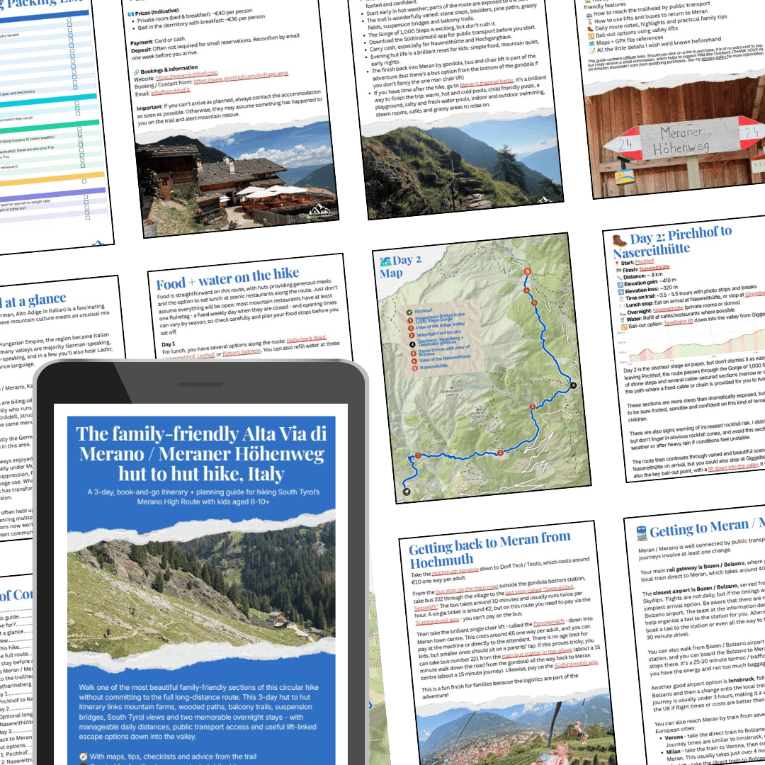
Meraner Höhenweg / Alta Via di Merano family friendly hut to hut hike: A 3 day, book-and-go hiking guide
YOUR COMPLETE GUIDE TO A BEAUTIFUL, OFF-THE-BEATEN-TRACK HUT TO HUT HIKE SUITABLE FOR KIDS 8 TO 10+ IN NORTHERN ITALY - WITH EVERY DETAIL HANDLED FOR YOU
Want to hike one of South Tyrol’s beautiful mountain trails as a family - or solo, or with an adult group - with dramatic views, working farms, cosy huts, balcony paths, suspension bridges and a brilliant finish back into Meran by gondola and chairlift?
This downloadable PDF gives you a clear way to walk a beautiful 3 day section of the Meraner Höhenweg / Alta Via di Merano - and it's suitable for families with confident kids aged from around 8 to10+.
Forget piecing together hiking blogs, translating German and Italian hut websites, or wondering whether the route is suitable for children. This guide gives you a practical, book-and-go plan for a proper South Tyrol hut to hut adventure; created by a parent who’s hiked the route as a solo woman and assessed it specifically for families.
✔ WHAT YOU’LL GET INSIDE
🗓️ A complete 3-day hut to hut itinerary:
A family-friendly section of the Meraner Höhenweg from Katharinaberg / Monte Santa Caterina to the Hochmuth gondola, with manageable daily stages and two overnight stops.
🧭 Step-by-step logistics:
Exactly how to reach the trailhead from Meran by bus, where to stay before the hike, and how to return to Meran at the end using the Hochmuth gondola and the Segenbühel chairlift.
🏡 Detailed hut and overnight information
Practical pages for both huts, as well as all the info you need for an optional alternative hut, covering rooms, food, showers, payment, booking details, family-friendly features and what to expect when you arrive.
🔁 Bail-out options
Clear notes on where you can descend into the valley if weather, timings or energy levels don’t go to plan.
🎒 Packing lists for adults and kids:
A realistic hut-hiking packing list designed for families carrying their own kit, including what children can carry and what adults should keep in their own packs
🗺️ Custom maps + GPX files:
Day-by-day maps and GPX files to help with offline navigation on the trail.
🥾 Real-world trail advice
Honest guidance on terrain, stone steps, narrow paths, cable-secured sections, suspension bridges, rockfall warnings, and where both adults and children need to be sure-footed and confident.
🍽️ Food and water planning
Where to eat along the route, which lunch stops to check in advance, where to refill water.
💡 What I wish I’d known before I went
From when to hike and how to check lift opening times, to why this route also makes a brilliant short adult getaway.
🌟 WHY IT’S WORTH £12
Planning a hut to hut hike with kids is exciting - but it can also be fiddly.
You need to know whether the distances are realistic, whether the huts work for families, how to reach the trailhead, where to eat, what to pack, when the lifts run, and what to do if you need to shorten the route.
This guide removes the guesswork: No endless research, translating multiple hut websites, or complicated car logistics.
Just a clear, tested plan for a beautiful 3-day section of the Meraner Höhenweg / Alta Via di Merano; with mountain huts, South Tyrol food, big views, public transport logistics, bail-out options and all the practical details pulled together in one place. Written by someone who has personally tested the route.
For £12, you get a beautifully organised guide to help you plan a proper South Tyrol hut to hut adventure with confidence; whether you’re hiking with outdoorsy kids, as a solo adult, or with friends.
TERMS & CONDITIONS OF PURCHASE:
- By purchasing this digital product, you agree that it is for your personal use only. Your licence is non-transferable and you may not share, distribute, reproduce or resell any part of this guide.
- Due to the instant nature of digital downloads, all sales are final. By completing your purchase, you give express consent to immediate access and acknowledge that you waive your right to cancel or receive a refund.
- This guide is provided for general information only. While created with care, it is not professional mountain or safety advice. Wild Bee Outdoors and the author accept no liability for injuries, losses or damages arising from its use. You are responsible for evaluating conditions, checking current maps and forecasts, carrying appropriate equipment and making safe decisions on the trail.