


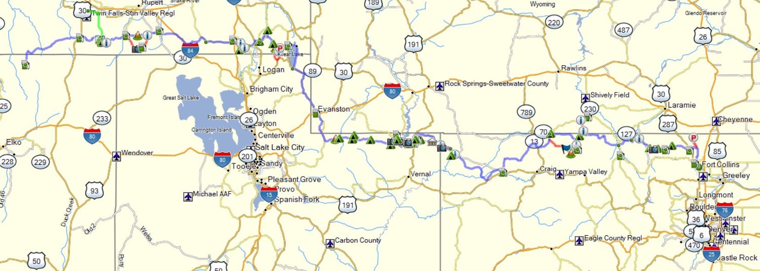
Fort Collins, CO to Jarbidge, NV Backcountry ADV route (F2J)
Ideal Front Range Colorado (Fort Collins) dirt track to ride west to Jarbidge, NV with all connections in between.
Need a new/return/connecting Backcountry / ADV route?
.GPX track files (an open source file) to ride a motorcycle (big bike friendly dirt roads) or drive (Jeep roads) east / west.
-Includes 8 individual (main track) .gpx files, plus 1 complete single .gpx
-Design focus is as much dirt as possible.
-These are not turn-by-turn routable routes. These are fixed line tracks always showing the correct way thru.
-Tracks includes camping options, some lodging options, key fuel stop, viewpoints plus bonus tracks.
-Connects well with all other popular routes.
-Requires a GPS or a powered smartphone & app (Rever, GAIA, OSMAND).
-User assumes all risk and responsibility. No guarantees implied.
Tip:
-.gpx tracks can be displayed in Google Earth Pro for desktop (PC & Mac).
-Download & install from here - https://www.google.com/earth/about/versions/
-Open program once installed: Click "file" - click "open" - select "all files" (to be viewed, otherwise .gpx files are hidden) - select the .gpx file - make sure all boxes are selected for options - click OK.
-Your tracks are now visible in Google Earth to explore.
Thanks,
Moto Routes - Bill