

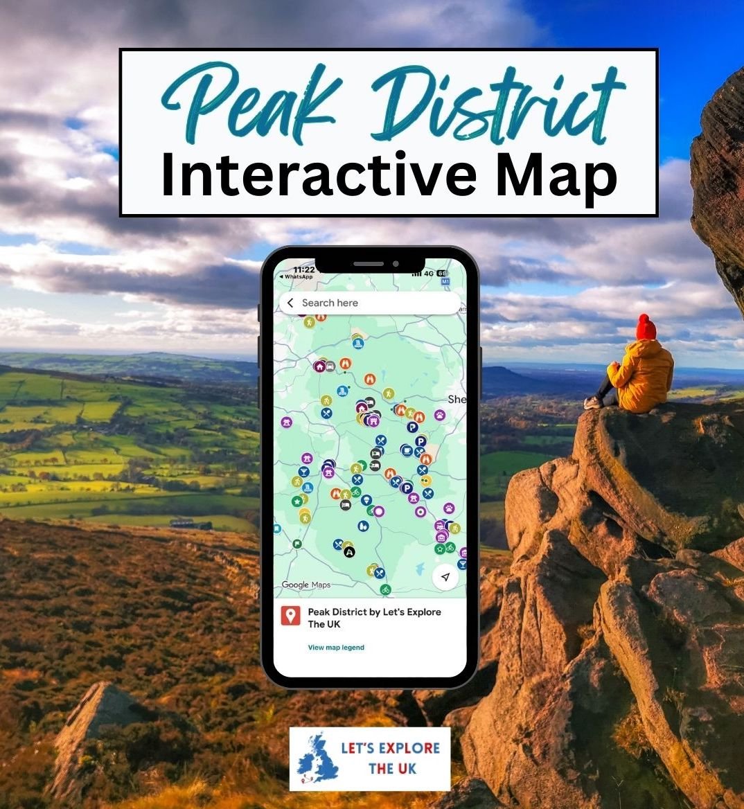
🗺️ Peak District Travel Planning Map
On Sale
£9.99
£9.99
I created this interactive travel planning map to help you explore the Peak District National Park without hours of research, endless tabs, or second-guessing where to go next.
Inside, you’ll find 150+ carefully chosen places so you can plan relaxed day trips, weekends away, hikes, longer trips and scenic drives in just a few clicks.
Instant access. Lifetime use.
✨ What You’ll Find Inside
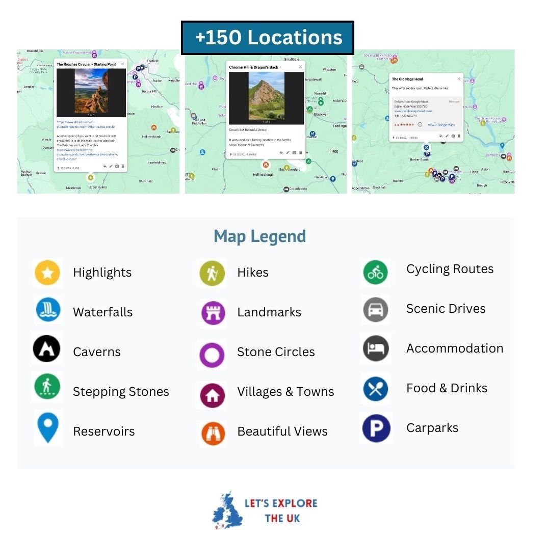
This custom Google Maps travel planning map includes:
- ⭐ Highlights – bucket-list places worth prioritising
- 🌿 Natural landmarks – waterfalls, caves, stepping stones, reservoirs
- 🥾 Hikes & walk starting points – clear places to begin the hike with Alltrails links
- 🏘️ Quaint villages & towns
- 🏰 Landmarks & attractions – stately houses, castles, farms, local sights
- 🌄 Beautiful views & viewpoints
- ✨ Unique places
- 🚴 Cycling routes
- 🚗 Scenic roads
- 🍽️ Food & drink – pubs, cafés, restaurants, ice cream parlours
- 🏡 Accommodation
- 🅿️ Car parks near walks and attractions
Everything is organised into clear categories so you can see what’s nearby and build your days naturally.
⏱️ Save Hours of Planning
- No more jumping between blogs, screenshots, and saved posts
- See what’s close to you
- Ideal for weekend trips, day trips, spontaneous exploring and longer trips
- Works directly inside Google Maps on your phone or desktop
⚠️ Please Note
This is a digital product.
You’ll receive a downloadable PDF with a link to the Google Map immediately after purchase.
Due to the nature of digital products, all sales are final.