


OSM (GPKG) - Europe : kosovon (125.6 MB)
OpenStreetMap (OSM) data is a free, open-source geographic dataset created and maintained by a global community of contributors. It includes detailed information about roads, buildings, land use, waterways, and other features of the physical environment. OSM data is widely used in mapping, navigation, and spatial analysis because it is openly accessible, regularly updated, and covers locations all over the world.
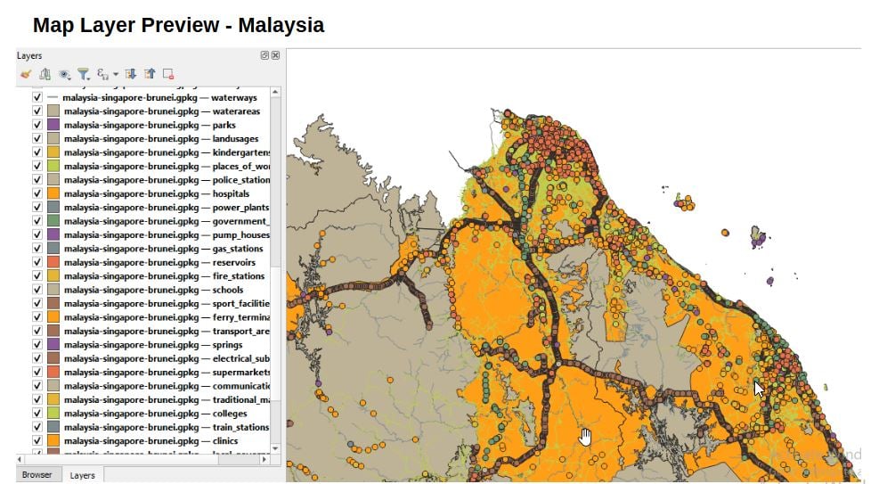
The OpenStreetMap (OSM) data, obtained from Geofabrik, was processed using a specific structured data model to generate GIS-ready spatial layers. The downloaded .osm.pbf file was parsed with PyOsmium to extract key features such as roads, buildings, and land use based on relevant OSM tags. These features were then exported to the GeoPackage (GPKG) format using GDAL/OGR, with all data projected in EPSG:4326 (WGS 84). The GeoPackage format was chosen for its simplicity and efficiency, as it stores multiple layers within a single, portable file.
The extracted data has been systematically structured to support advanced GIS spatial analysis, incorporating multi-criteria evaluation, spatial modeling, and geostatistical techniques. This facilitates evidence-based urban and regional planning, strategic infrastructure development, and rigorous spatial risk assessments aimed at optimizing public safety through hazard mapping, emergency response planning, and vulnerability analysis
Click to view the structure of : GIS Feature Layers
Feel free to download the sample data to see if it suits your needs
Download Sample Data (Cyprus) - gpkg
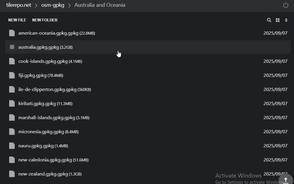
Website : https://tilerepo.net/
**Due to the large file size, you will receive a text file with the file details and a download link.