
Cloud Identiication Printable 18×24 Wall Chart, Reference Poster
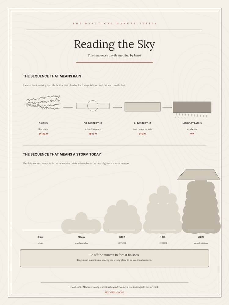
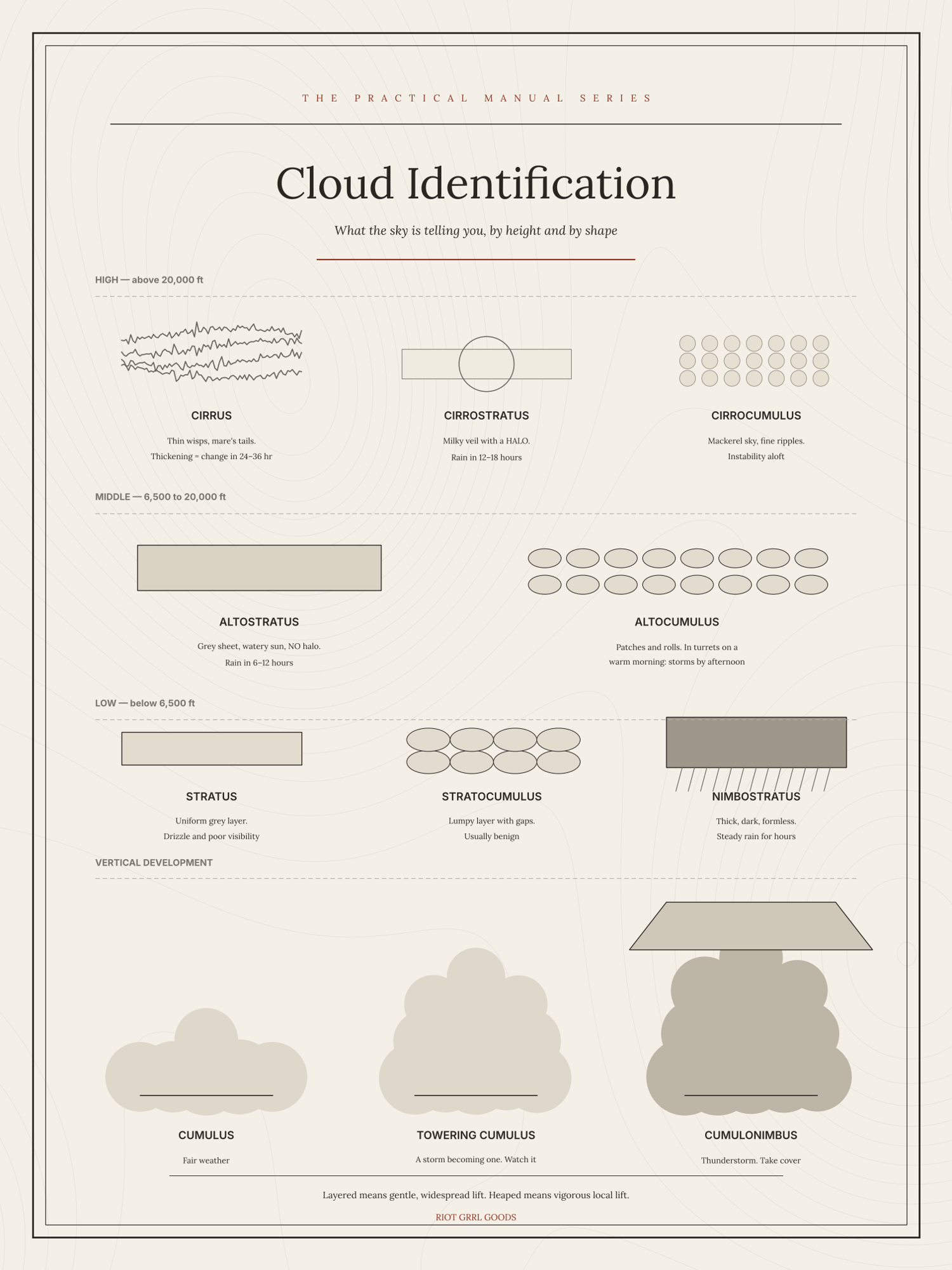
Every cloud type worth knowing, sorted by the height it forms at, with what each one tells you about the next twelve to twenty-four hours.
High clouds — cirrus, cirrostratus, cirrocumulus — are ice, five miles up, and they are the ones that arrive first. Middle clouds, altostratus and altocumulus, are the thickening. Low clouds — stratus, stratocumulus, nimbostratus — are the weather itself. And standing apart from all of them, cumulus and cumulonimbus, which build vertically through every layer and make their own rules.
The chart is drawn, not photographed, which is the point: a photograph shows you one sky on one day, and a drawing shows you the shape you are looking for. Each cloud carries a short line on what it means, so you can stand in the yard, find the match, and know what is coming.
A single sheet, 18 × 24 inches. Print it at any copy shop, office store or online print service — ask for 18 × 24 on matte or satin paper. You get a print-ready PDF and a PNG, so whichever your printer prefers is already in the file.
Adapted from public-domain US government field manuals and National Weather Service material, redrawn and set fresh. Not an official publication and not endorsed by any agency. Instant download — print it as many times as you like.