
Utah (Frisco–Milford): Alteration, Mines, Claims & No-Go Land Map Pack (NASA EMIT, GeoTIFF, GPKG, KMZ)
The San Francisco Mountains – Cactus Range – Milford area of Beaver County, Utah is arid, well exposed and historically productive (MRDS records are dominated by lead, copper, silver, zinc and gold, with some aluminium, potassium and fluorine records as well). This pack gives you a ready-to-use, documented set of mapped SURFACE layers for a 40 × 40 km tile, so you can screen the district in your own GIS in minutes instead of days, and see what is already known, claimed or off-limits.
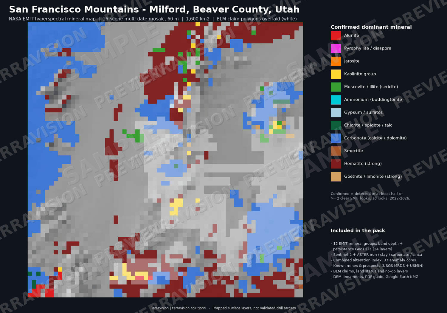
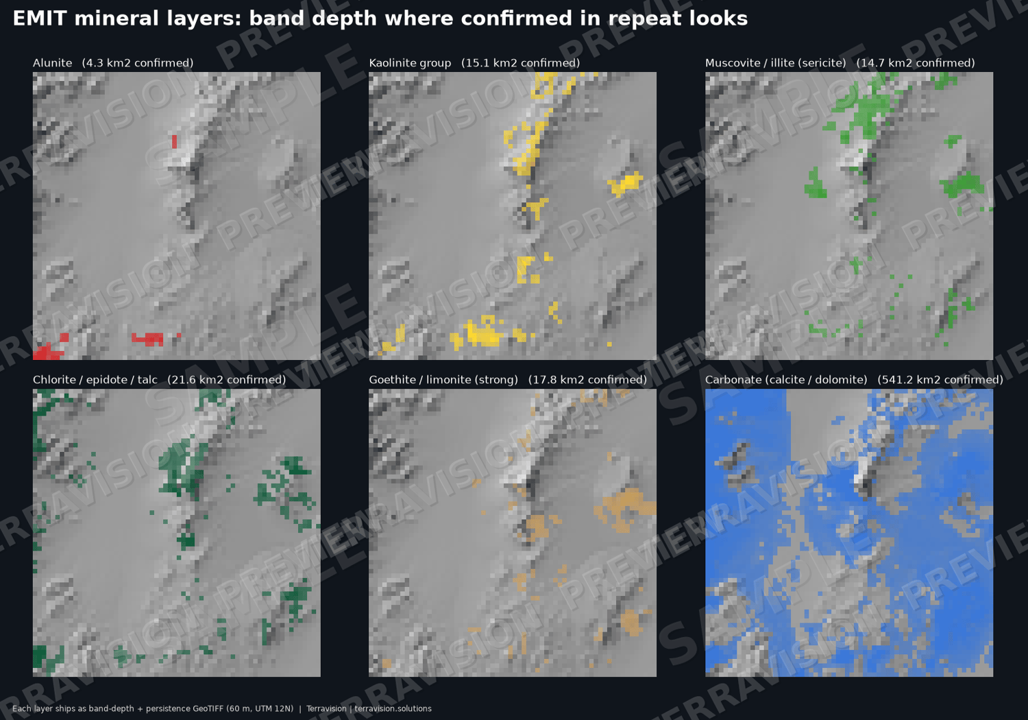
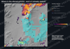
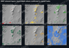
NASA EMIT is the centrepiece. The ISS-based EMIT imaging spectrometer identifies minerals from their absorption features. We processed 16 clear-sky looks (2022-2026, median 10 looks per pixel) into 60 m multi-scene mosaics for 12 mineral groups - alunite, kaolinite, muscovite/illite, pyrophyllite/diaspore, smectite, ammonium, jarosite, goethite/limonite, hematite, carbonate, chlorite/epidote/talc and gypsum - each with band depth, persistence (how many looks agree) and a "confirmed" flag. A split-half agreement check shows which layers to trust (alunite, carbonate, hematite, kaolinite) and which are tiny or indicative only (pyrophyllite, smectite, ammonium; jarosite has no confirmed pixels). Confirmed areas in the tile: alunite 4.3 km², kaolinite 15.1, muscovite/illite 14.7, chlorite/epidote/talc 21.6, goethite/limonite 17.8, carbonate 541, hematite 379.
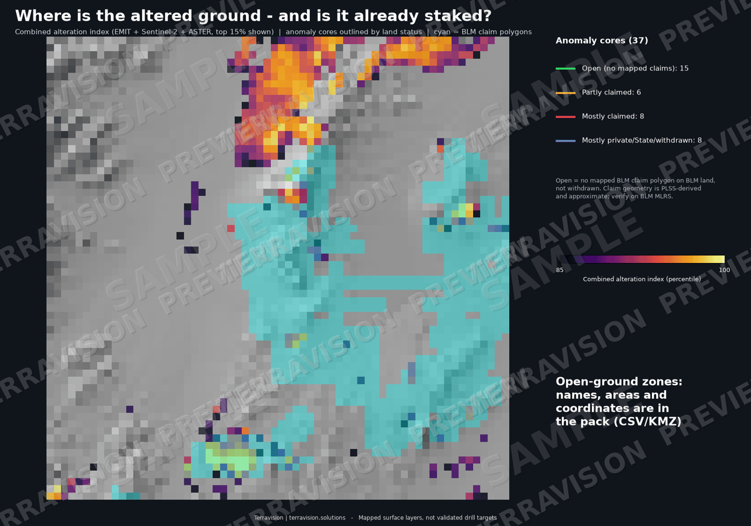
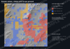
Add Sentinel-2 and ASTER clay, iron, carbonate and silica indices at 20 m, a combined alteration index with 37 cores, 23 footprints and 73 EMIT mineral patches (all with coordinates and land-status percentages), DEM lineaments (172) checked against USGS Quaternary faults and the 1:500k Utah geologic-map faults, 126 fault intersections, and a BLM mining-claims overlay (2,941 lode and placer polygons) showing which ground is claimed and which is open BLM land.
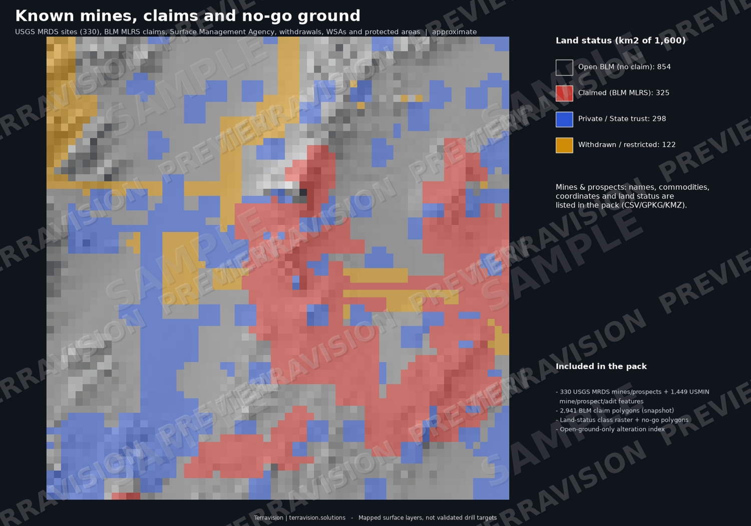
Known mines & prospects: 330 USGS MRDS records (194 past producers, 33 producers, 17 prospects, 86 occurrences; lead, copper, silver, zinc and gold dominate) with commodity, status, record link and the land status at each point, plus 1,449 USGS topographic-map workings from USMIN (681 prospect pits, 487 shafts, 262 adits, 12 open pits) and 30 dump polygons.
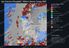
Land status / no-go ground: every 20 m pixel is classed open BLM (854 km² / 53 %), claimed (325 km² / 20 %), private / State trust / other non-BLM (299 km² / 19 %) or withdrawn / restricted (122 km² / 8 %). The no-go layer holds 25 polygons: the Wah Wah Mountains Wilderness Study Area (30 km²), 16 federal land withdrawals (many are old stock-driveway, power-site or water-reserve orders - flagged "check case file") and 3 PAD-US restricted areas. No designated wilderness and no military land fall inside this tile (checked against BLM SMA, BLM withdrawals and the DoD military-bases layer; the nearest Utah installations are 137+ km away).
What the overlays say, honestly: the strongest alteration is largely spoken for. None of the 4.3 km² of EMIT-confirmed alunite is on open BLM ground (27 % is inside claims, 71 % is State trust or private land); about 60 % of the confirmed kaolinite is inside claims, with 29 % on open ground; muscovite/illite is the most open (37 %). The top-ranked alteration core (EMIT alunite + kaolinite) coincides with the USGS MRDS record "White Mt" (commodity codes aluminium and potassium, consistent with alunite) and is 98 % inside claim polygons; the largest alteration footprint (2,220 ha, muscovite-dominated) is open ground. The pack is as useful for showing what is NOT available as what is.
Everything is in WGS84 / UTM 12N with a full layer index, and a 10-page PDF explains the method, how to use it in QGIS / ArcGIS / Google Earth, what the layers can and cannot show, and the data credits and licences.
Who it's for: exploration geologists and consultants screening the Utah Basin and Range; juniors and prospectors planning desktop review; GIS analysts; students and teachers working with EMIT / ASTER / Sentinel-2.
What's inside:
- 47 GeoTIFF layers (EMIT 60 m: 24 mineral band-depth / persistence layers + class map + argillic and iron scores; Sentinel-2 / ASTER 20 m indices; combined alteration index incl. open-ground-only version; land-status class; claims count; hillshade; structure density indices)
- GeoPackage (13 layers) + 13 GeoJSON: alteration cores (37), footprints (23), EMIT patches (73), DEM lineaments (172, classified), mapped faults (320), fault intersections (126), BLM claims snapshot (2,941), land-status polygons, no-go / restricted areas (25), surface-management agency, USGS MRDS mines & prospects (330), USMIN mine features (1,449) and dump polygons (30)
- 13 CSV tables with lon/lat and UTM coordinates, scores, land status, structure metrics, EMIT agreement checks, scenes used, no-go list, military-land check, layer index
- 3 Google Earth KMZ files (alteration pack with raster overlays; structure; mines, claims and land status)
- 10-page PDF guide: method, GIS use, limits, data sources and licences
- Size: ~115 MB download (~118 MB unzipped)
Important: These are mapped surface layers - NOT drill targets, not a resource or reserve estimate, and not investment or exploration advice. Satellite spectra see only the top microns of the ground, so they map clays, micas, alunite, carbonate and iron oxides but do NOT detect gold, silver, copper or any commodity, and say nothing about what is beneath the surface. A mineral pixel is a spectral match, not a grade, and the layers have not been validated by drilling, sampling or field work. Clay-bearing alluvium, volcanic tuffs, carbonate rocks, desert varnish and mine dumps can mimic what you are looking for. Claim data are an approximate snapshot (BLM MLRS, 19 Nov 2026, PLSS-derived geometry) - verify with BLM, SITLA and Beaver County. Known-deposit points come from USGS MRDS (frozen 2011) and USGS topographic-map symbols: locations are approximate and the status words are historical, not a current assessment. Land-status and withdrawal boundaries are approximate screening layers, not legal title or access records - verify with BLM MLRS and the case files before staking or fieldwork. Staking on federal land in Utah requires a US citizen or US entity; State trust (SITLA) land is leased, not staked; private land needs the owner's consent; and "open" in this pack does not mean you can stake it.
Specs: CRS WGS84/UTM 12N (EPSG:32612); extent E 279000-319000, N 4239000-4279000 (40 x 40 km, about 38.46 N, 113.30 W); EMIT 60 m, Sentinel-2/ASTER 20 m; formats GeoTIFF, GPKG, GeoJSON, CSV, KMZ, PDF. Works in QGIS, ArcGIS, Google Earth, Global Mapper, Python/R.
Licence: single-user licence for your own internal and commercial use; no resale or redistribution of the pack. Third-party data credited in the guide.
Delivery: instant download after purchase (one ZIP).
FAQ
- Does it tell me where the gold / silver / copper is? No. Satellites map surface minerals only. The pack maps alteration minerals and shows which of that ground is known, claimed or restricted.
- Does it tell me where to drill? No. It is not a drill-target product and is not exploration advice.
- Does it show known mines and prospects? Yes: 330 USGS MRDS records (status, commodities, ID, link) and 1,449 USGS topo-map workings, each tagged with land status. They are historical public records, not a current assessment.
- Does it show wilderness, withdrawals and military land? Yes: the no-go layer holds a Wilderness Study Area, federal withdrawals and PAD-US restricted areas, and the land-status layer separates State trust / private land. No military land falls inside this tile (checked against BLM SMA, BLM withdrawals and the DoD installations layer).
- Can I stake the open ground? Not necessarily: claim polygons are approximate, and staking on federal land requires a US citizen or US entity. State trust and private land are not open to staking. Check BLM MLRS, SITLA and the county.
- How accurate are the mineral maps? Each mineral has an agreement score (guide section 3). Treat pyrophyllite, smectite and ammonium as indicative; they are tiny here.
- Which software do I need? Any GIS that opens GeoTIFF/GeoPackage, or Google Earth for the KMZ.
- Refunds? Because this is an instant digital download, sales are final once downloaded. If a file is faulty or won't open, email chris.tps.info@gmail.com, use the contact form at terravision.solutions, or send a Payhip message, and we will fix it or refund you.
Pricing (USD): single-user licence $295 launch price (list $395); team licence (up to 5 users) $795; academic / student licence $99. All three are the same download and differ only in licence terms.
Terravision | terravision.solutions