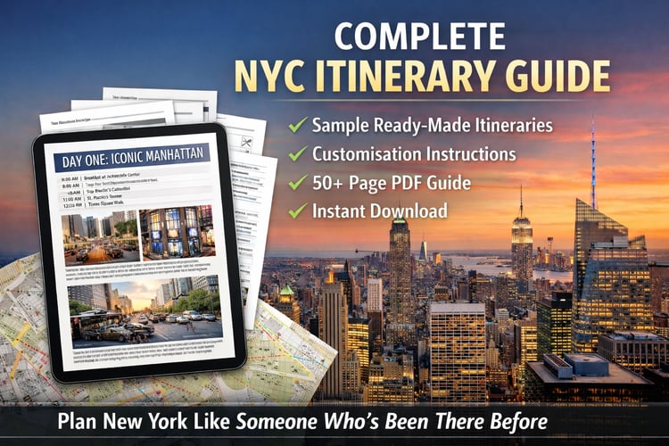


NYC Walking Map Printable | Attraction Cluster Guide | New York City Travel Planner PDF | Instant Download
Stop backtracking across New York City. This 2-page printable clusters every major attraction by neighbourhood — so you walk smarter, see more, and waste zero time doubling back.
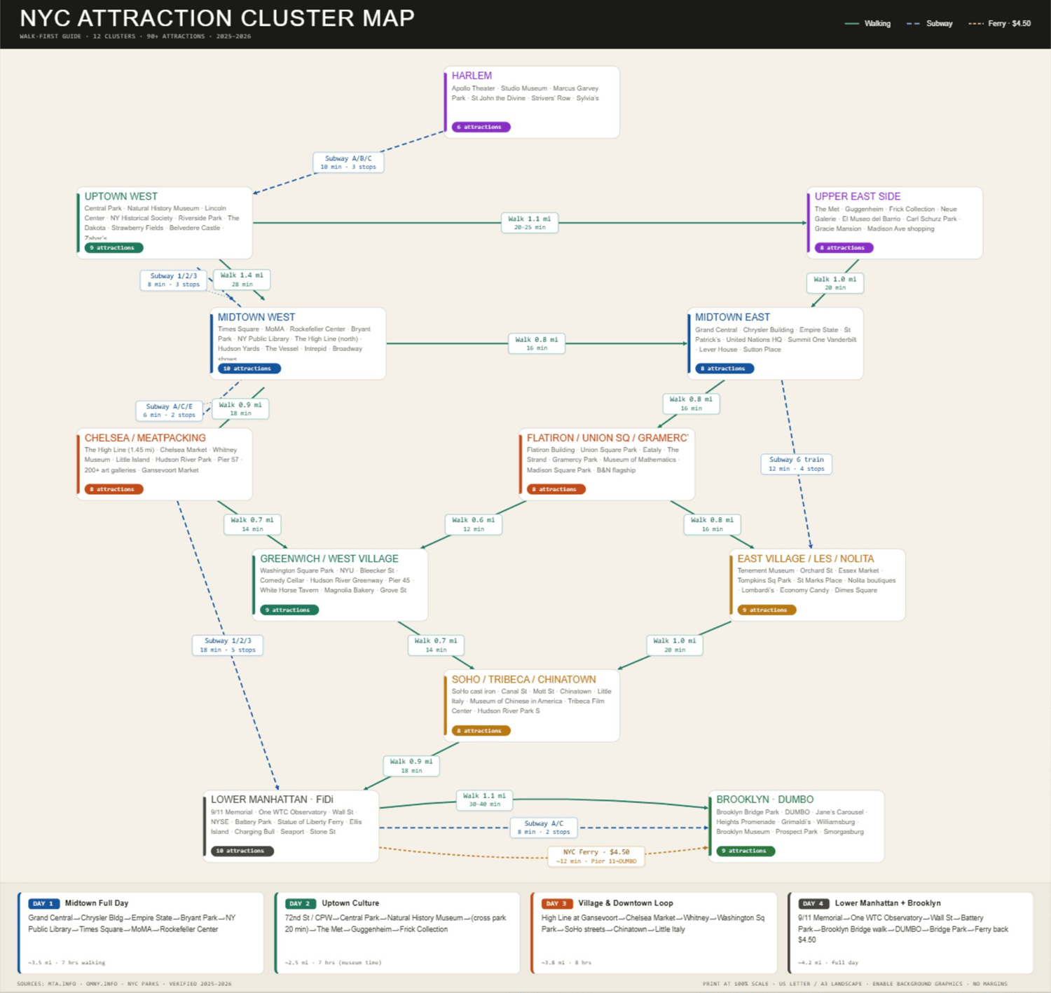
Most tourists zigzag all day because they plan by attraction, not by location. This map fixes that. It groups 90+ attractions into 12 walkable clusters, shows you exactly how far apart everything is, and draws the fastest connections between neighbourhoods — so your day flows like a local's, not a first-timer's.
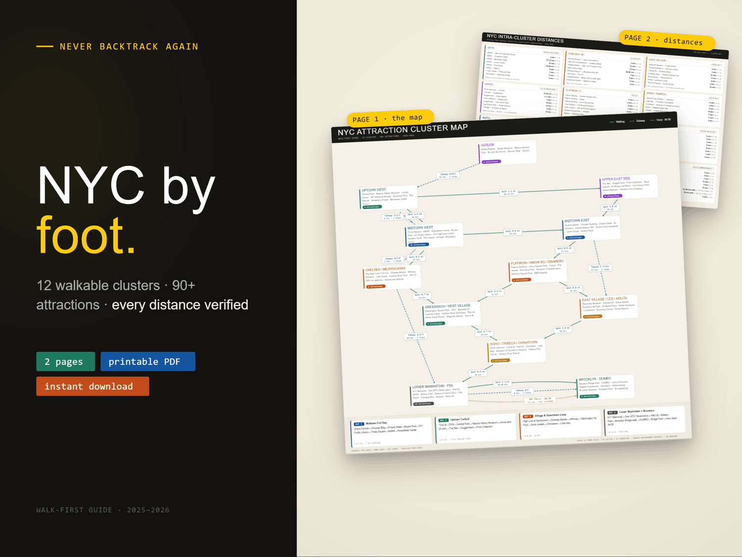
WHAT YOU GET
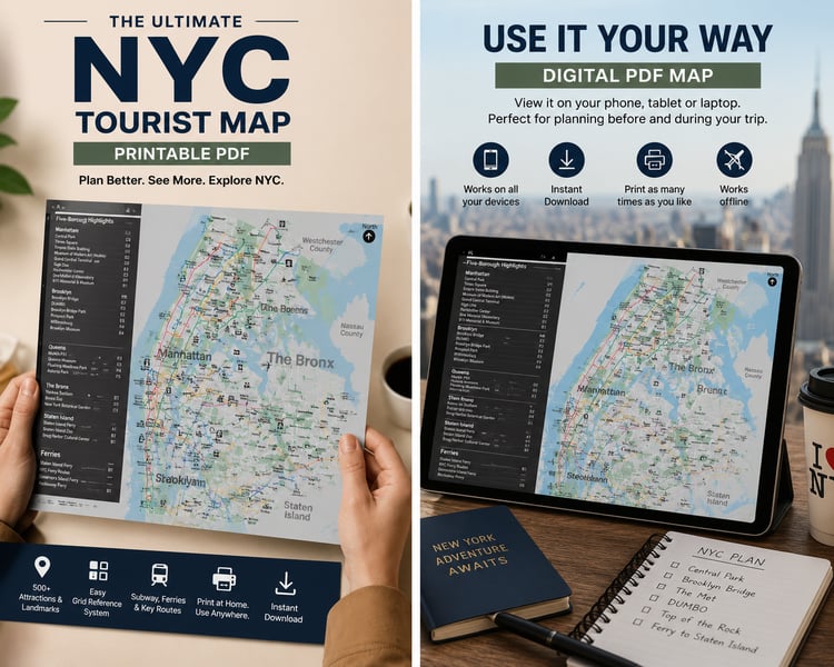
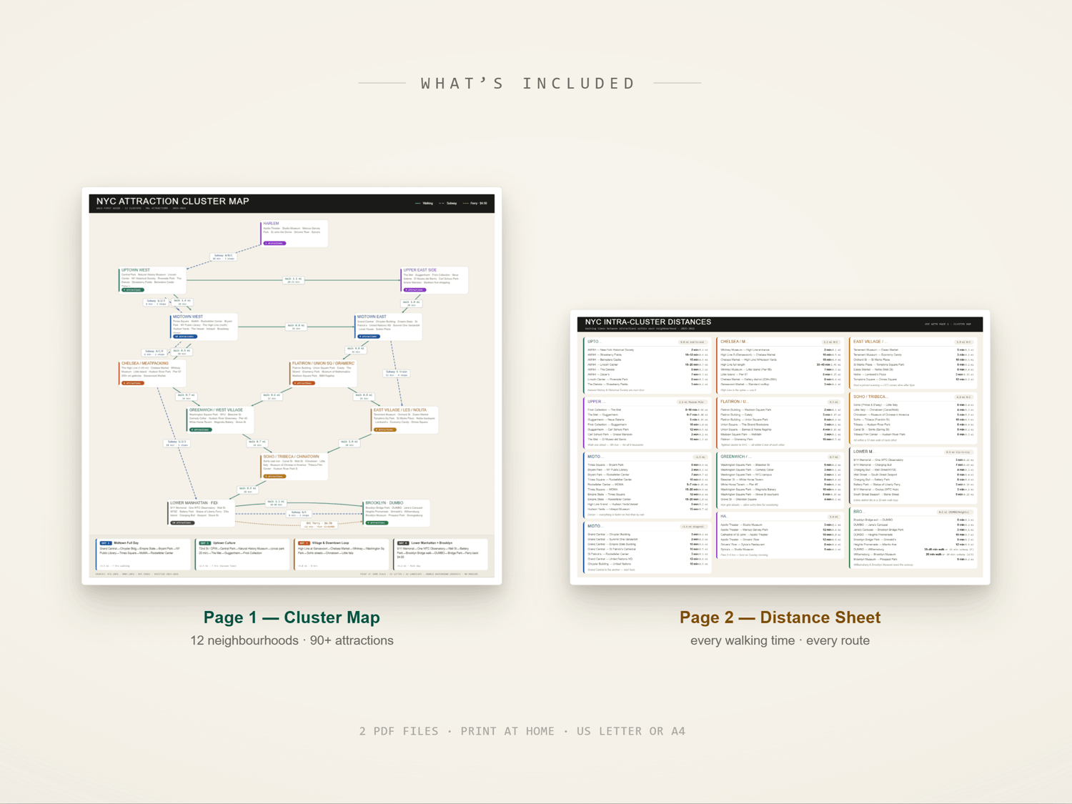
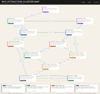
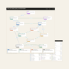
▸ Page 1 — NYC Attraction Cluster Map The visual overview. 12 colour-coded neighbourhood clusters across Manhattan and Brooklyn. Walking connections shown with distance and time (e.g. "0.8 mi · 16 min"). Subway connections marked where walking isn't practical. Ferry route from Lower Manhattan to Brooklyn included. Works as your daily planning sheet and on-the-go reference.
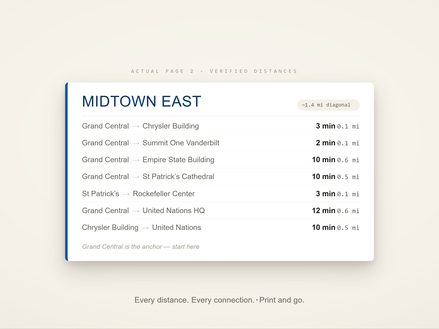
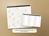
▸ Page 2 — Intra-Cluster Distance Reference Sheet The deep-dive companion. Every attraction within each cluster listed with walking time and distance to its neighbours. Know before you leave the hotel: "Grand Central to the Chrysler Building is a 3-minute walk." No more opening Google Maps every 5 minutes.
WHAT IT SOLVE ────────────────────────────
✓ No more zigzagging — cluster your day by neighbourhood, not by attraction name
✓ No more guessing — every distance is verified (2025–2026 data from MTA and Google Maps)
✓ No more dead time — the fastest walking routes between clusters are marked
✓ No signal needed — print it before you leave, works completely offline
✓ No app to download, no subscription, no login — just paper
CLUSTERS INCLUDED
Harlem · Uptown West (Central Park) · Upper East Side (Museum Mile) · Midtown West · Midtown East · Chelsea & Meatpacking · Flatiron & Union Square · Greenwich & West Village · East Village & LES · SoHo, Tribeca & Chinatown · Lower Manhattan · Brooklyn (DUMBO & Brooklyn Heights)
HIGHLIGHT
→ 90+ attractions organised by walkability →
Verified walking times (not crow-flies — actual street routes) → Subway lines named (not just "take the subway") → NYC Ferry route included ($4.50, Pier 11 to DUMBO) → 4 suggested day itineraries in the footer → Colour-coded by neighbourhood so you can spot your cluster at a glance → Printed in black & white or full colour — both look great
HOW TO DOWNLOAD AND PRINT
- Add to cart and complete checkout
- Your 2 PDF files arrive instantly — check your Etsy account under "Purchases and Reviews" or your confirmation email
- Open in any PDF viewer (Adobe Reader, Preview, Chrome)
- Print on US Letter (8.5 × 11 in) or A4 in landscape orientation
- Enable "background graphics" or "print backgrounds" in your print settings so the colours come through
- No special paper needed — standard office paper works perfectly
Can't print? Save both PDFs to your phone and use them as digital references — pinch to zoom on any cluster.
FILE DETAILS
- Format: PDF (2 files)
- Size: US Letter landscape (11 × 8.5 in) — also prints well on A4
- Colour versions: Full colour + black-and-white print-friendly version included
- Resolution: Print-ready (300 dpi)
- Data verified: 2025–2026 (MTA.info · OMNY.info · NYC Parks · Google Maps)
BEFORE YOU BUY — PLEASE NOTE
This is a digital download. No physical item will be shipped. Due to the instant-download nature of digital products, refunds cannot be offered once files have been accessed — but please message me if you have any trouble with your files and I'll sort it out right away.
Questions? Message me any time. I respond within 24 hours.