


High-Quality US Regional Map Vector Set
High-Quality US Regional Map Vector Set
Enhance your projects with this professional collection of US Regional Maps. This digital download provides a comprehensive breakdown of the United States into its four primary Census Bureau regions, plus a complete national overview. Perfect for educators, data analysts, designers, and presentations.
What’s Included:
You will receive a digital zip file containing 10 high-quality files:
- 5 Scalable SVG Vectors: Perfect for resizing without losing resolution. Great for web design and high-end printing.
- 5 High-Resolution JPEGs: Ready to use immediately in PowerPoints, Word docs, or social media.
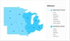
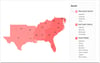
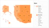
- Maps Featured:
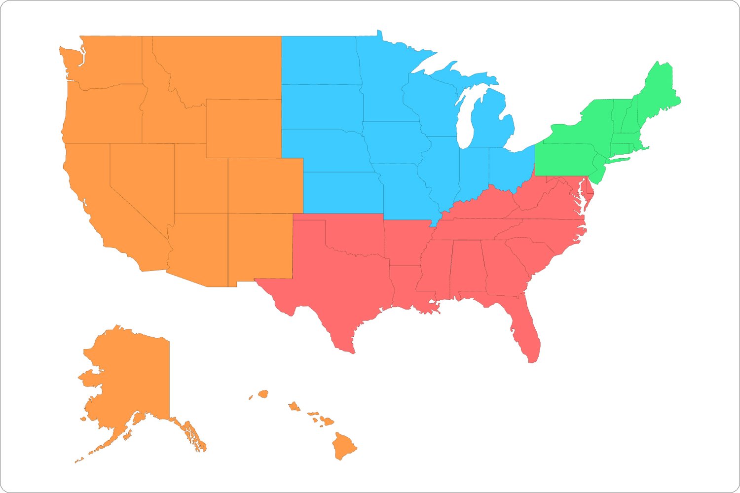
- Full US Overview: A color-coded map showing all 50 states grouped by region.
- Northeast Region: Detailed breakdown of New England and Middle Atlantic divisions.
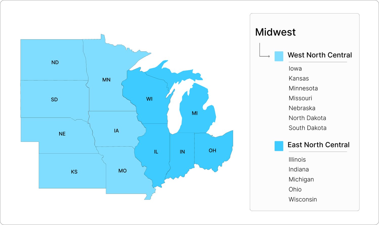
- Midwest Region: Includes the East North Central and West North Central divisions.
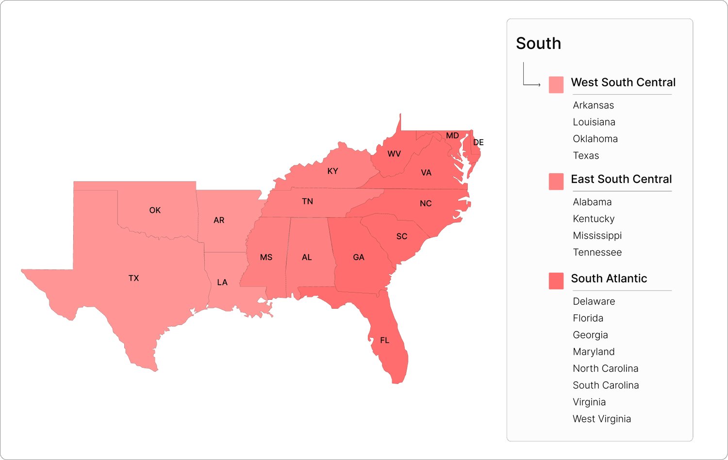
- South Region: Covers South Atlantic, East South Central, and West South Central divisions.
- West Region: Includes both the Mountain and Pacific divisions (including Alaska and Hawaii).
Why Choose This Set?
Clean & Professional: Designed with a modern, vibrant color palette that is easy on the eyes.
Organized Data: Each regional map includes a clear sidebar legend listing every state within its specific division.
Versatile: Use them for demographic reporting, sales territory mapping, educational worksheets, or infographics.
Instant Download: Get started on your project immediately after purchase!