
Reading the Sky — Printable 18×24 Wall Chart, Two Cloud Sequences for Forecasting Without Instruments
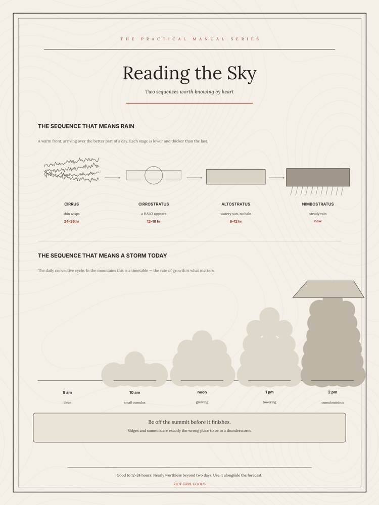
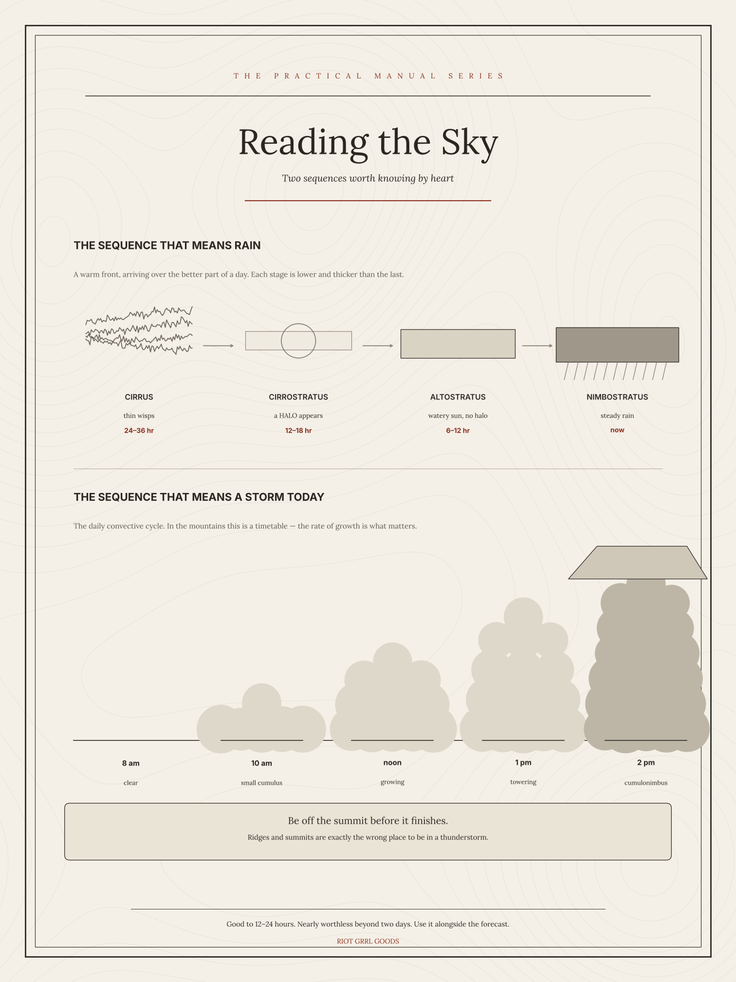
Identifying a cloud is the easy half. The useful half is noticing the order they arrive in, and that is what this chart is for.
Two sequences, side by side. The first is the one that means rain: high wispy cirrus, thickening to a milky cirrostratus with a halo round the sun, lowering to grey altostratus, and then nimbostratus and the rain itself — typically twelve to twenty-four hours from the first sign to the first drop. The second is the fair-weather sequence: scattered cumulus building through the morning, flattening in the afternoon, dissolving at evening.
Underneath, the other signals that cost nothing to read — wind backing and veering, pressure falling fast against falling slow, smoke lying flat or rising, dew on the grass at dawn and what its absence means.
If you only ever hang one weather chart, this is the more useful of the two, because it teaches you to watch change rather than take snapshots.
A single sheet, 18 × 24 inches. Print it at any copy shop, office store or online print service — ask for 18 × 24 on matte or satin paper. You get a print-ready PDF and a PNG.
Adapted from public-domain US government field manuals and National Weather Service material, redrawn and set fresh. Not an official publication and not endorsed by any agency. Instant download — print it as many times as you like.