
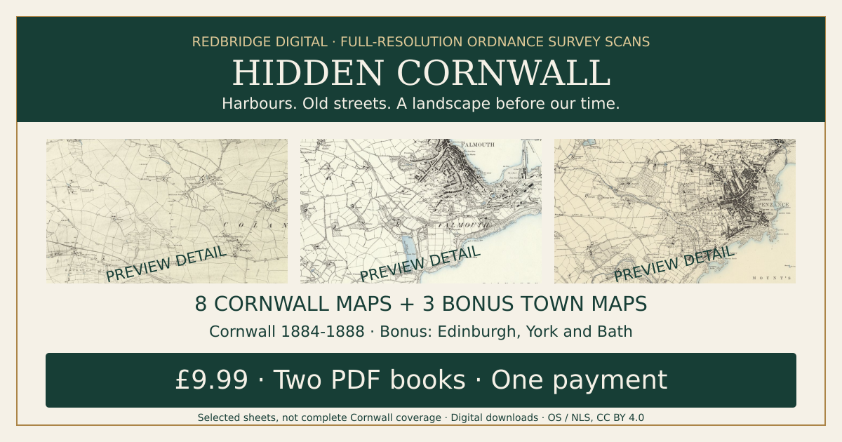
Hidden Cornwall - 8 Victorian Ordnance Survey Maps + 3 Bonus Town Maps
CORNWALL: DOWNLOAD, PRINT OR FRAME
DOWNLOAD — £9.99: buy the digital edition on this page.
Physical choices below are separate purchases for ONE map. Choose Cornwall 01–08 at checkout. £7.99 UK delivery for each physical offer; mixed-product basket shipping is calculated at checkout. No digital purchase required.
PRINT — one Cornwall map: A3 £24.99 / A2 £34.99
FRAMED — one Cornwall A3 map £109.99
CHRISTMAS GIFT IDEAS
Give them a place they love. Explore familiar streets through genuine historic Ordnance Survey maps — a thoughtful digital gift for a local-history lover. This is a downloadable product; printed maps and frames are sold separately.
Prefer a paper print?
Printing only: one unframed historic map on 200gsm matte art paper. A3 £24.99 or A2 £34.99, plus £7.99 UK tracked delivery per order. No PDF purchase is required. View print-only sizes, map choices and availability
Prints are purchased separately; this listing remains a digital download.
YOUR CORNWALL. BEFORE YOUR TIME.
Explore genuine Victorian Ordnance Survey maps in full native online resolution, with an illustrated companion and editable research pages.
£9.99 once. Two downloadable PDF books. No subscription.
WHAT YOU GET
• A 16-page map atlas: eight complete Cornwall sheets published 1884-1888, plus three complete bonus town sheets.
• A 16-page illustrated map-reading companion, source links and 13 editable research fields.
• Three bonus maps at no extra charge: Edinburgh (1853), York (1853) and Bath (1886)—Scotland, northern England and southwest England.
THE CORNWALL SELECTION
Bodmin and western surroundings; Newquay district and St Columb Minor; Chacewater and approaches west of Truro; Godrevy and Gwithian; Camborne and southern surroundings; Falmouth and Budock; Penzance, Madron and Paul; the eastern Bude-Stratton district.
Selected county sampler, not continuous Cornwall coverage or complete coverage of every named town. The Chacewater sheet is not a dedicated Truro town-centre plan. Bonus sheets do not promise full modern city coverage. Sheet numbers, dates and sources are listed in the PDFs.
FULL RESOLUTION
Complete atlas images retain every native pixel supplied by the NLS online image service, without downsampling or upscaling. Tiles are assembled and JPEG-compressed for delivery. These are not archival TIFF masters. Original fading and scan imperfections remain. The guide uses cropped illustrations and reduced bonus previews.
RESEARCH AND DELIVERY
Record an address, compare dated evidence and plan archive searches. Digital downloads only; no printed books or bespoke genealogy. The atlas is a large file: use reliable Wi-Fi and save it securely. A PDF app supporting forms is recommended for the editable pages.
Buyer-email stamping and limited downloads deter casual forwarding; screenshots cannot be prevented absolutely. Contact the seller if delivery fails.
CREDITS AND RIGHTS
Ordnance Survey. Reproduced with the permission of the National Library of Scotland under CC BY 4.0. Images assembled/recompressed; guide illustrations cropped. Source scans are also available at NLS and retain their existing reuse rights. Your purchase pays for selection, checking, compilation, the original guide and presentation. Independent Redbridge Digital publication.