
The Five Terrain Features — Printable 18×24 Wall Chart, Reading Contour Lines on a Topographic Map
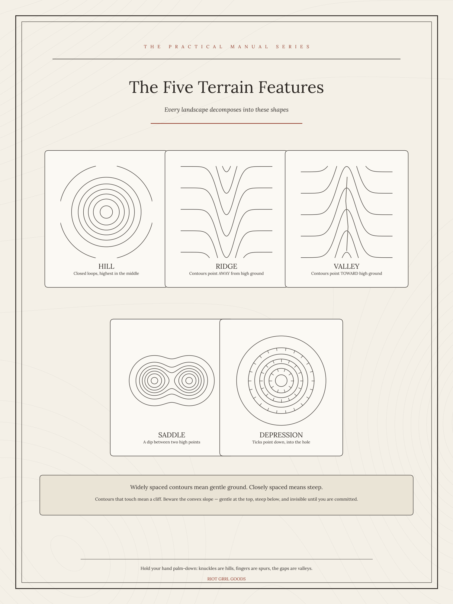
Hill, ridge, valley, saddle and depression — the five shapes every topographic map is built from, each one drawn twice: once as the contour rings you will actually see on the map, and once as the land in profile beside it.
That pairing is the whole teaching. Contour lines are abstract until you have seen the same feature from the side, and then they stop being abstract permanently. The valley and the ridge are the pair that catch people, because both are nested U-shapes — the chart shows you plainly which way the U points in each case, and the rule for telling them apart in the field when you have no idea which way is uphill.
The depression gets its tick marks explained, and the saddle gets the treatment it deserves, since a saddle is where you cross a ridge and therefore where you will actually be walking.
A single sheet, 18 × 24 inches. Good on a wall at home, better taped inside a locker or a map case. Print it at any copy shop, office store or online print service — ask for 18 × 24 on matte or satin paper. You get a print-ready PDF and a PNG.
Adapted from public-domain US government field manuals, redrawn and set fresh. Not an official publication and not endorsed by any agency. Instant download — print it as many times as you like.