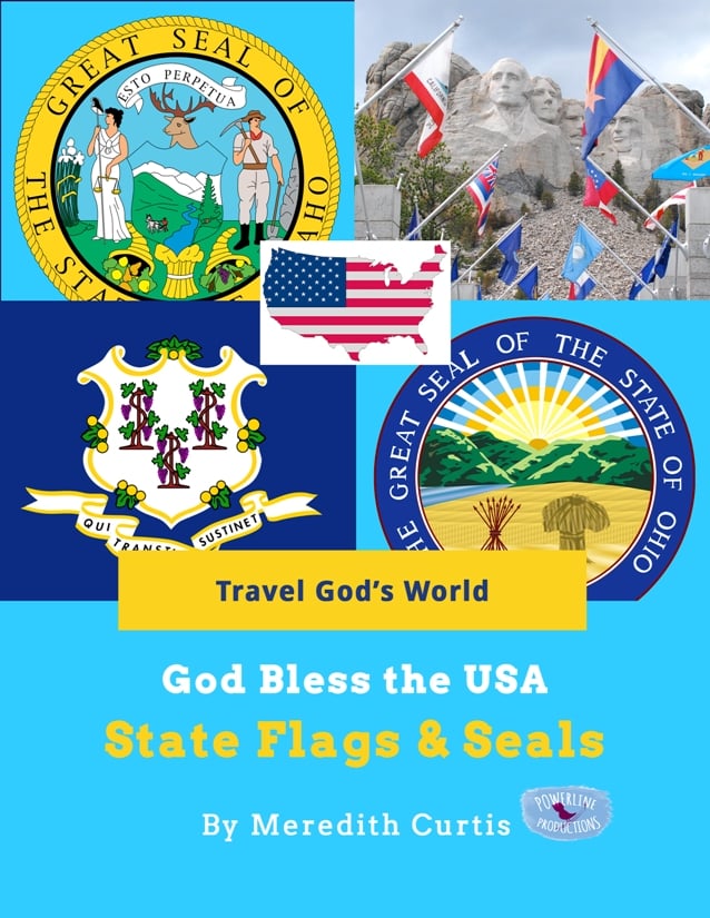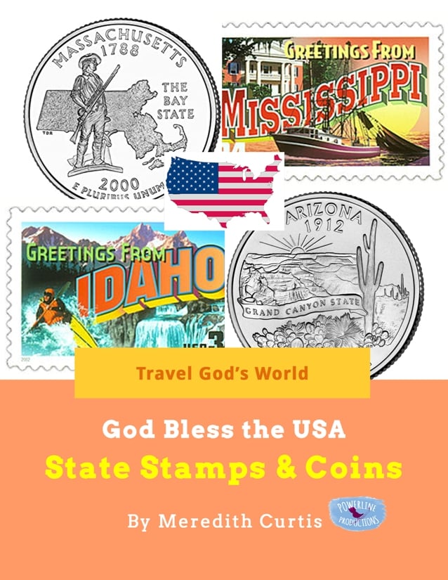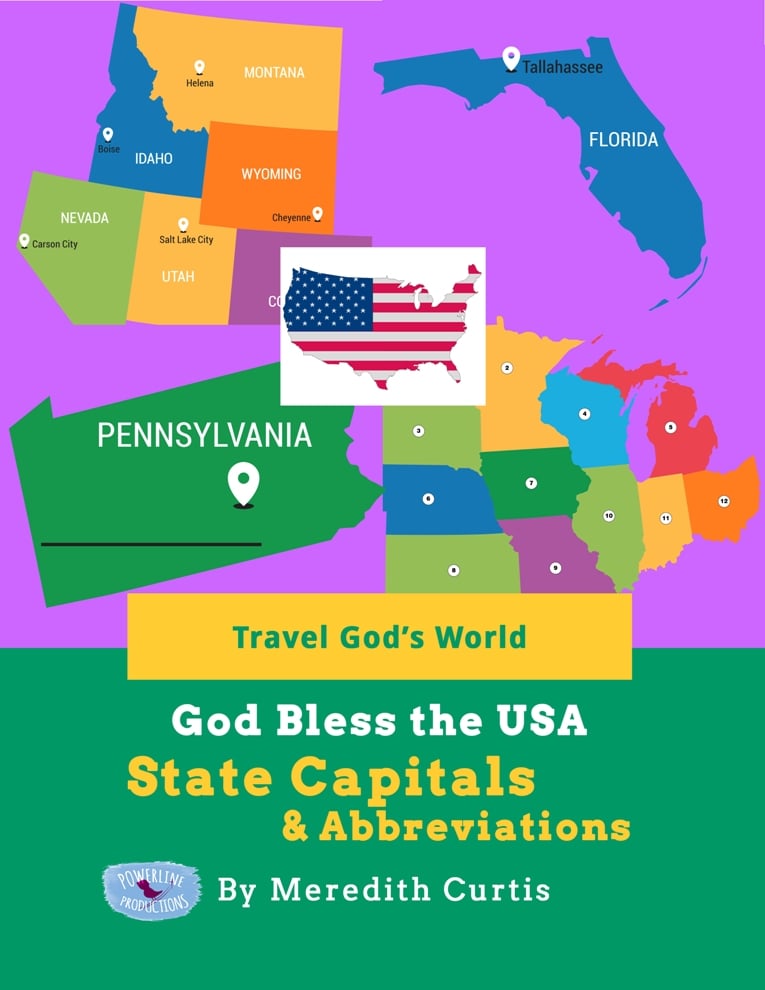


God Bless the USA State Capitals & Abbreviations
On Sale
$27.00
$27.00
Created to supplement God Bless the USA Exploring States & Territories, God Bless the USA State Capitals & Abbreviations explores state capitals and abbreviations. We can travel across the USA together to visit 50 states to explore their capitals and capitols in this amazing US geography curriculum supplement.
Students can become familiar with and memorize capitals and abbreviations with these printable worksheets. Students even learn the difference between capitol and capital! Creative worksheets add fun to learning state geography for upper elementary and middle school students.
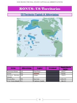
Bonus: Capital worksheets for our five territories!
Bonus: Answer Key included in back of book!
God Bless the USA State Capitals & Abbreviations opens up with an explanation of capitals, capitols, and the difference between them, as well as why we use state abbreviations. From there, the book is divided up into the following sections: Southern states, Mid-Atlantic states, New England states, Southwest states, Western states, Pacific states, and Territories.
At the beginning of each section, students learn about the capital and capital of each state and the five territories. Matching state capitals or abbreviations to their maps is easy and fun for children and even teens. It gets students familiar with all the capitals and abbreviations for the first time or as a review. If you are memorizing state capitals and abbreviations, then these printable pages can be used over and over to help with the memorization process.
Each geographical section is set up in the following way:
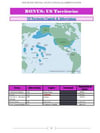
First Page: Map with states and capitals. Chart with states, abbreviations, capitals, statehood date, and population. These charts were taken from the resource section of God Bless America: Exploring States & Territories.
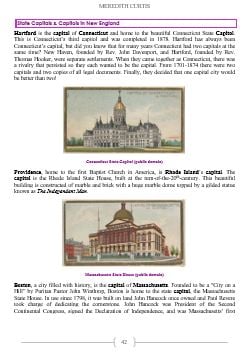
State Capitals & Capitols Pages: Quick intro to each state capital and state capitol. (Don’t forget capital is a city and capitol is a building)
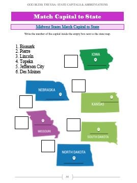
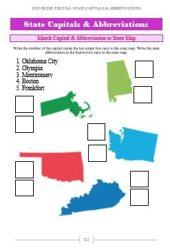
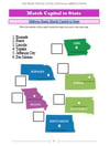
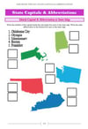
Match Capital to State Pages: Printable with numbered capitals and maps with small boxes next to them. Students write the number of the capital in box next to map.
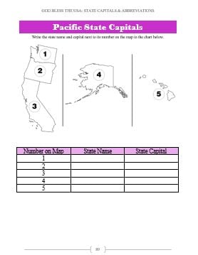
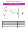
Numbered Map & Chart Pages: Printable with map of geographical section with a number in each state. In the chart below, next to the number, students write in the state name and capital.
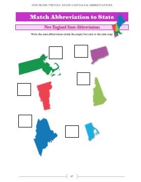
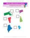
Abbreviations Pages: Printables of two kinds. Both have maps with small boxes next to them. The first pages have maps with the state name, and the next set are just the map of the state with no writing. Students must recognize the shape of the state. In both sets of printables, students write the state abbreviation in box next to map of its state.
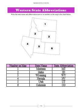
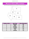
Numbered Map & Chart Pages: Printable with map of geographical section with a number in each state. In the chart below, next to the number, students write in the state name and abbreviation.
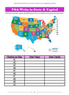
Write In Capital and Abbreviation Page: Printable with map of geographical section with a number in each state. In the chart below, next to the number, students write in the state name, capital, and abbreviation.
Color in States by Name, Abbreviation, or Capital Page: Printable with blank outline map of geographical section. There is a list of directions for student to color in a state a certain color by giving the name of the state, the abbreviation, or the capital. Students just follow the directions to make a colorful map.
Are you ready for a grand adventure from sea to shining sea? Join us today and learn geography the fun way with Travel God’s World!
Students can become familiar with and memorize capitals and abbreviations with these printable worksheets. Students even learn the difference between capitol and capital! Creative worksheets add fun to learning state geography for upper elementary and middle school students.
Bonus: Capital worksheets for our five territories!
Bonus: Answer Key included in back of book!
God Bless the USA State Capitals & Abbreviations opens up with an explanation of capitals, capitols, and the difference between them, as well as why we use state abbreviations. From there, the book is divided up into the following sections: Southern states, Mid-Atlantic states, New England states, Southwest states, Western states, Pacific states, and Territories.
At the beginning of each section, students learn about the capital and capital of each state and the five territories. Matching state capitals or abbreviations to their maps is easy and fun for children and even teens. It gets students familiar with all the capitals and abbreviations for the first time or as a review. If you are memorizing state capitals and abbreviations, then these printable pages can be used over and over to help with the memorization process.
Each geographical section is set up in the following way:
First Page: Map with states and capitals. Chart with states, abbreviations, capitals, statehood date, and population. These charts were taken from the resource section of God Bless America: Exploring States & Territories.
State Capitals & Capitols Pages: Quick intro to each state capital and state capitol. (Don’t forget capital is a city and capitol is a building)
Match Capital to State Pages: Printable with numbered capitals and maps with small boxes next to them. Students write the number of the capital in box next to map.
Numbered Map & Chart Pages: Printable with map of geographical section with a number in each state. In the chart below, next to the number, students write in the state name and capital.
Abbreviations Pages: Printables of two kinds. Both have maps with small boxes next to them. The first pages have maps with the state name, and the next set are just the map of the state with no writing. Students must recognize the shape of the state. In both sets of printables, students write the state abbreviation in box next to map of its state.
Numbered Map & Chart Pages: Printable with map of geographical section with a number in each state. In the chart below, next to the number, students write in the state name and abbreviation.
Write In Capital and Abbreviation Page: Printable with map of geographical section with a number in each state. In the chart below, next to the number, students write in the state name, capital, and abbreviation.
Color in States by Name, Abbreviation, or Capital Page: Printable with blank outline map of geographical section. There is a list of directions for student to color in a state a certain color by giving the name of the state, the abbreviation, or the capital. Students just follow the directions to make a colorful map.
Are you ready for a grand adventure from sea to shining sea? Join us today and learn geography the fun way with Travel God’s World!